
Vancouver Island Roadtrip - Cobalt Lake and 5040 Peak
Nestled on Vancouver Island - between Port Alberni and the popular coastal destinations of Ucluelet and Tofino, 5040 Peak presents a challenging ascent that leads to spectacular views and an immersive experience in the wild beauty of Vancouver Island.
The hike is 6.9km out-and-back with an elevation gain of 930m. For those from or familiar with Vancouver, its incline is comparable to the famed Grouse Grind, minus the well-maintained stairs. The rugged terrain is a mix of tree roots, exposed rocks, with sections that require navigating ropes, making it a true test of endurance and skill.
Preparing for the hike and camp
5040 Peak is a popular day hike destination, but to soak in all its beauty, we opted to backpack up and camp overnight.
Campsite options
5040 Peak allows wild camping, meaning you can technically camp anywhere and spots are first-come, first serve, no reservations required. Popular options include the following:
- at Cobalt Lake
- at 1350m by the Hišimy̓awiƛ Hut
- at the 1450m high alpine ridge
- at the 1536m/5040ft peak
Alternatively, if you would like a more modern experience, The Alpine Hut is reservable via the Alpine Club of Canada - Vancouver Island Section website.
Reminder to follow The 7 Principles of Leave No Trace if you’re camping.
Check the weather!
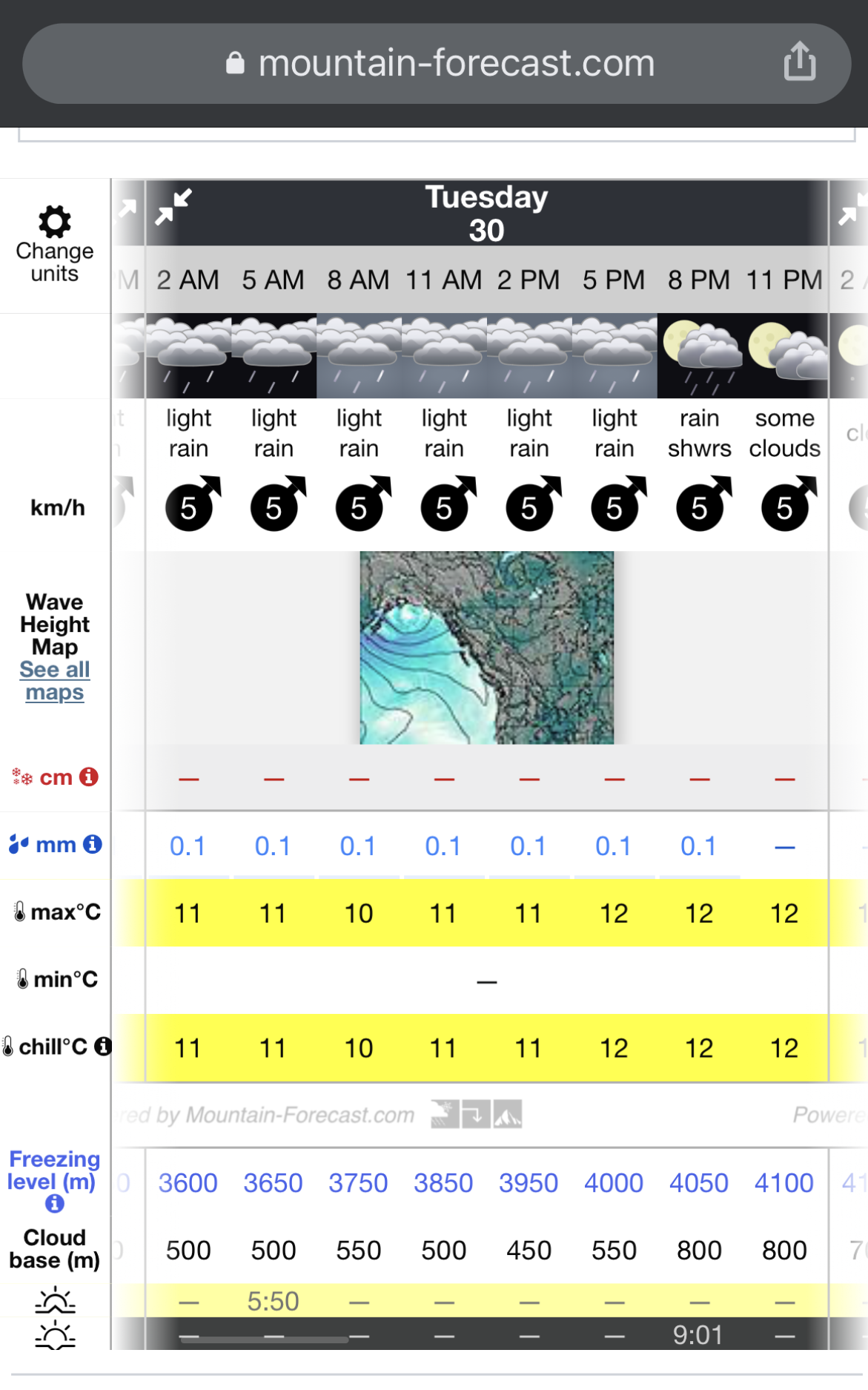
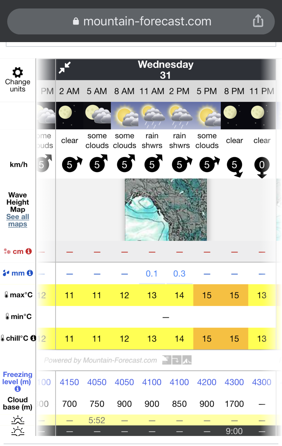
Days leading up to the hike, we used Klitsa Mountain - mountain-forecast.com (near 5040 Peak) to check the weather forecast. We strongly recommend utilizing this resource to adjust your hiking plans accordingly, even in hot summer days where you would think rain probability is low. Pacific Northwest weather is mysterious; today could be hot and sunny, but the next day soaking wet.
How the weather forecast helped our planning:
We initially intended to camp 2 nights (Monday Jul 29th and Tuesday Jul 30th), and head down on Wednesday Jul 31.
However, the weather forecast predicted rain for both Monday and Tuesday, with the cloud base expected to be lower than the peak, meaning we’d be shrouded in clouds throughout without views.
Fortunately, the forecast indicated that the rain will stop and skies will begin to clear starting at midnight on Wednesday.
In light of this, we’ve adjusted our plan: to brave the rain and hike up on Tuesday afternoon, camp, and make the most of the improved weather conditions on Wednesday before descending.
Weather forecast from mountain-forecast.com:
| Day 1 | Day 2 |
|---|---|
 |  |
View at the campsite:
| Tuesday Afternoon | Wednesday Morning |
|---|---|
 |  |
View at Ucluelet town center:
| Tuesday Morning | Wednesday Afternoon |
|---|---|
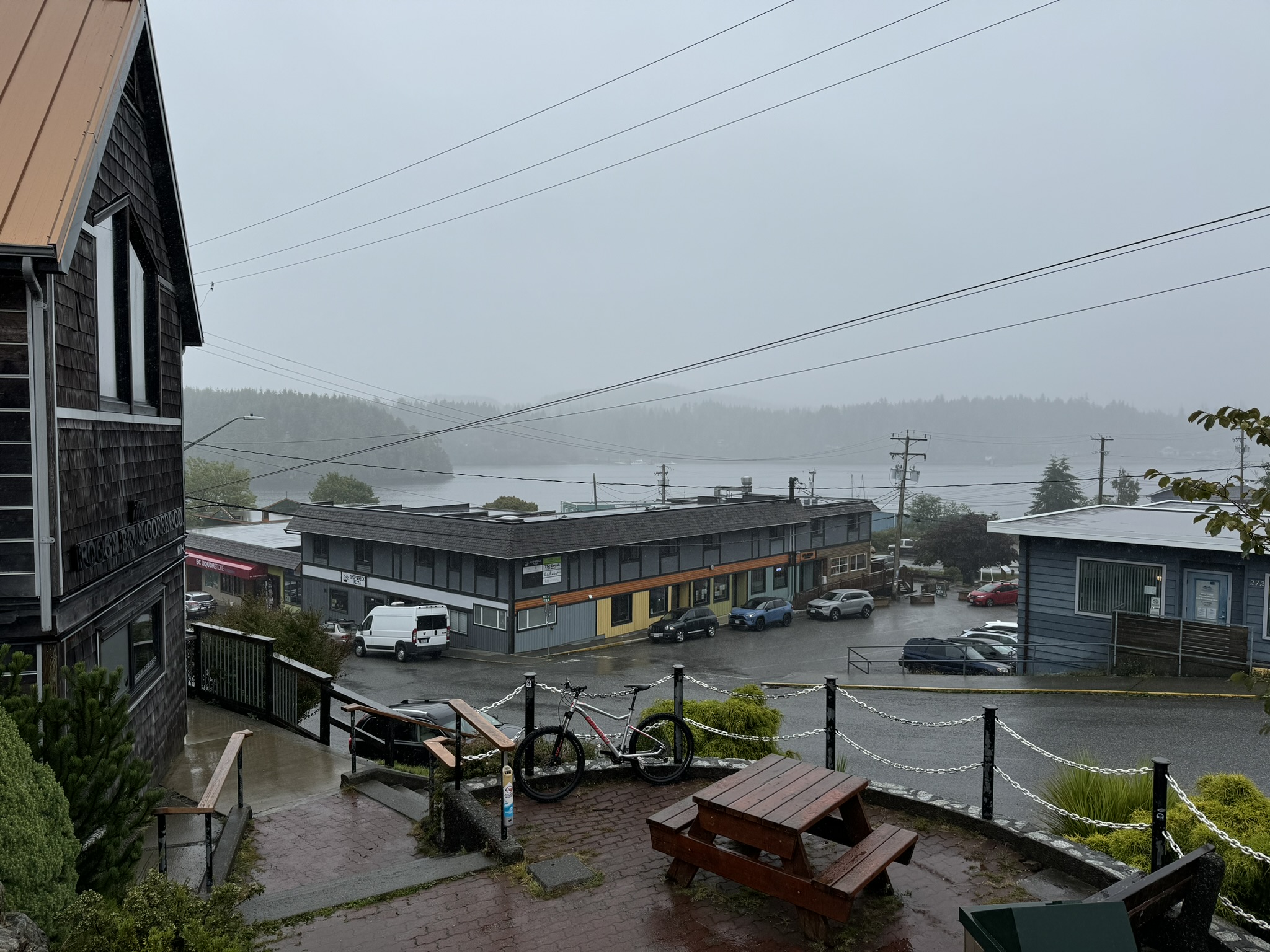 | 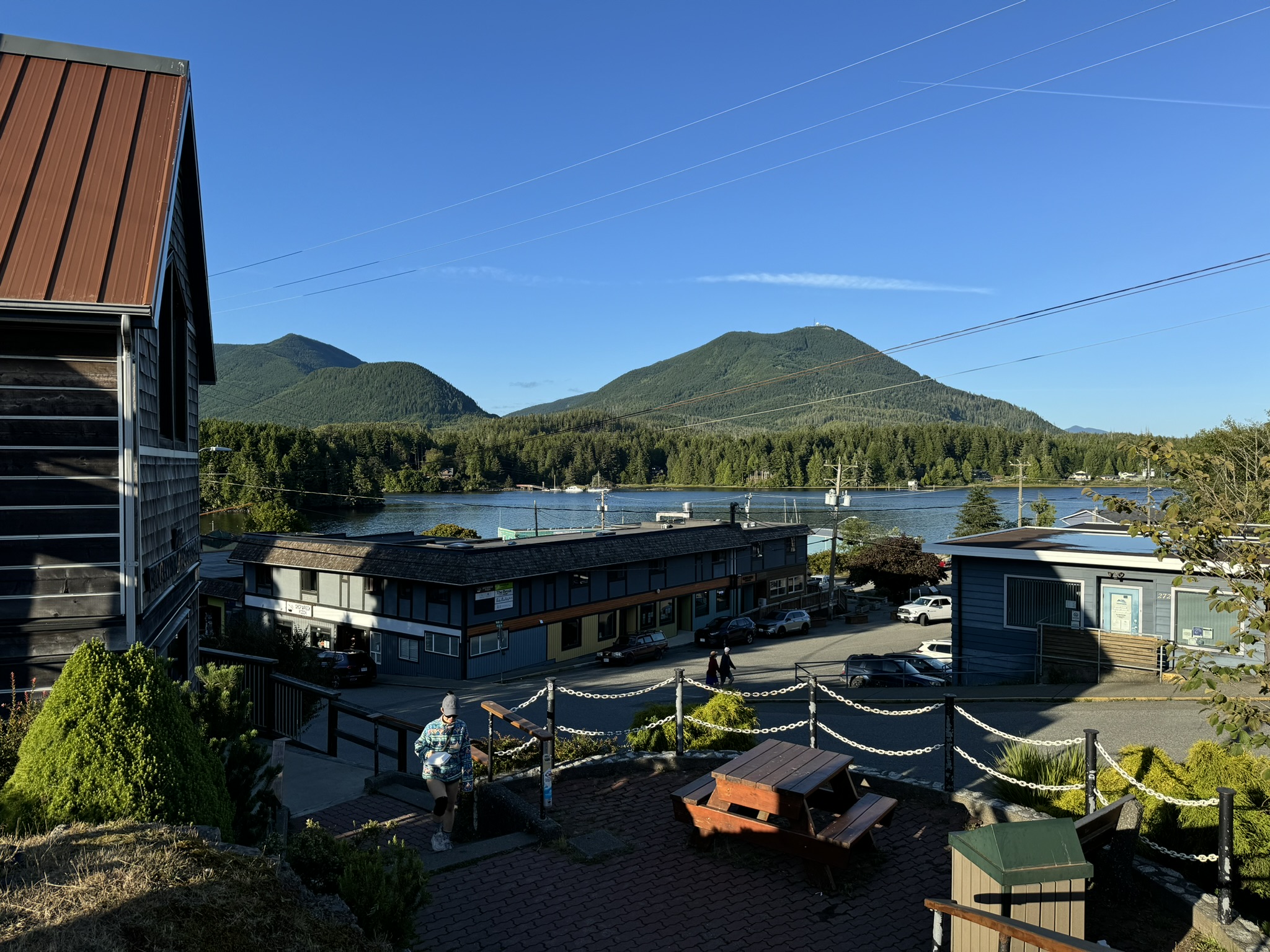 |
Arriving at the trailhead
If you are not from the area and travelling like us, Ucluelet and Port Alberni are both close options to stay the night before. Both towns are ~ 1 hour away from the trailhead.
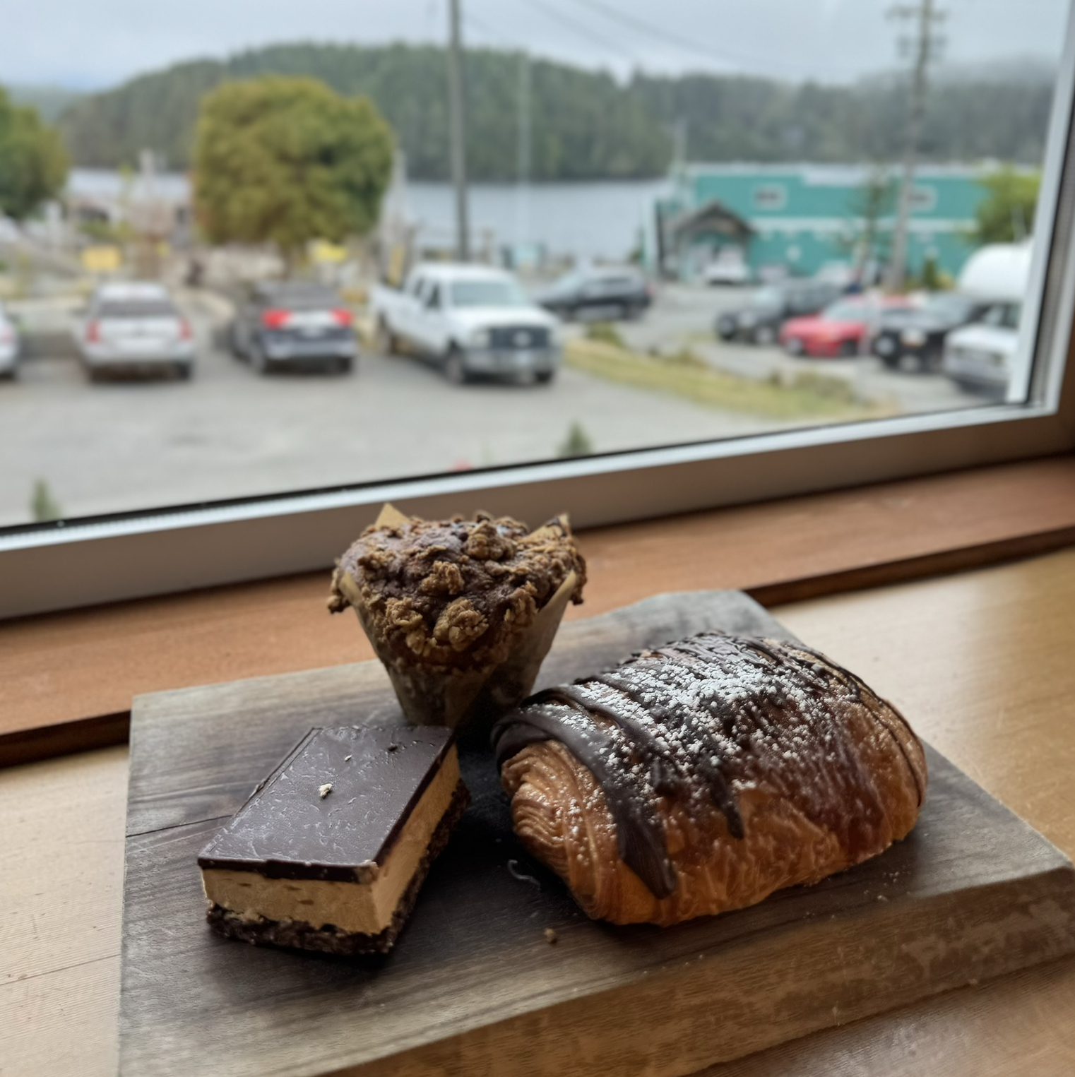
We stayed at Ucluelet and in the morning, enjoyed a coffee and breakfast at The Barkley Cafe before hitting the road.
We also highly recommend The Break Cafe & Bistro - their coffee and pastry options are just the comfort you’ll need before a hike. They are however closed on Wednesday and Thursdays - make sure you double check operation hours before you go.
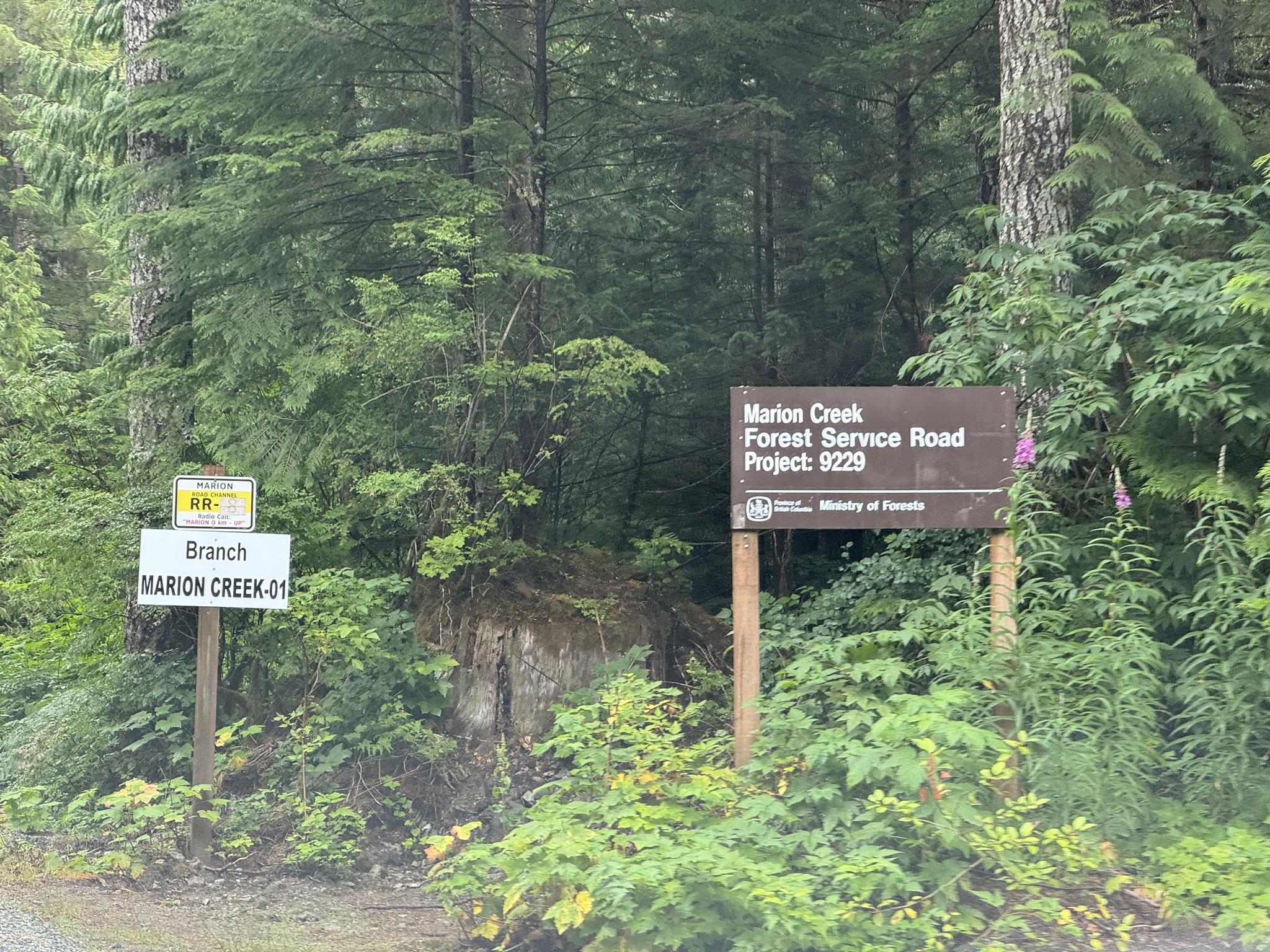
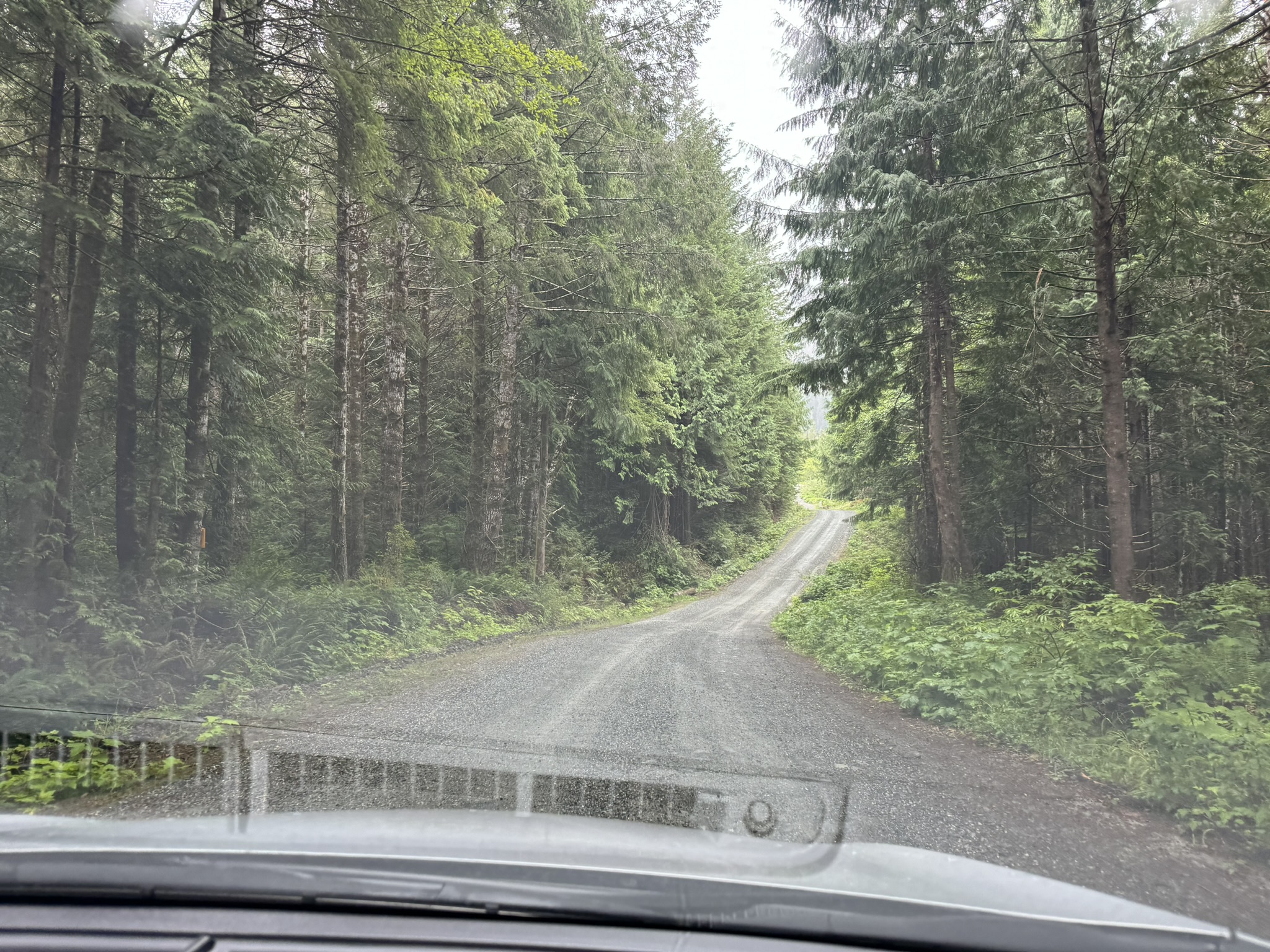
We followed Google Maps to get to the trailhead. The map does end earlier than the actual, final trailhead, but once you’re on the FSR, there’s only one route and you won’t miss it: just keep driving until you see vehicles parked and a small info board on the left indicating trailhead.
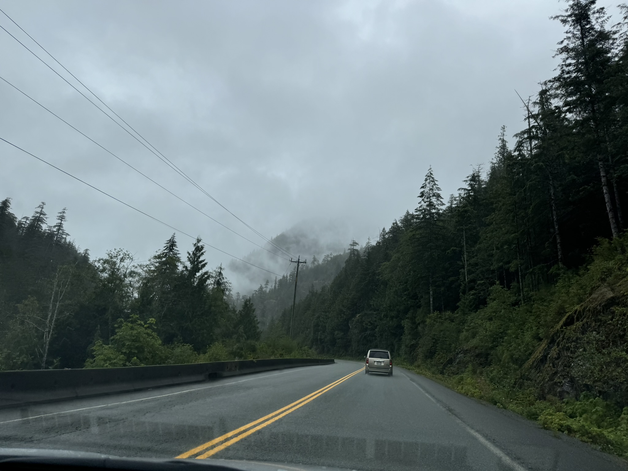
The important thing is to follow Google Maps to turn onto the Marion Creek Forest Service Road - it is quite a hidden pathway and easy to miss if you’re driving fast and not actively following map instructions.
FSR Condition
The FSR was recently repaired in May/June 2024, thanks to the ACC contacting forest services. Almost any sedan will make it to the trailhead, but a 4x4 is still recommended for keeping the gravel road intact. If you’re tackling the trail in winter months, make sure to check snow conditions via DriveBC webcam at Taylor River or Sentinel Hub - both resources recommended by ACC.
The Hike Up
As it was rainy Tuesday, we started the hike later than we normally would, around noon. To our surprise, despite the weather and the fact that it was a weekday, we were still greeted by around 10 hikers at the traihead, and met another 5-6 groups of hikers on the way up. On a sunny summer weekend, the trail will easily be packed so you’ll want to start ideally before 9am or after 4pm to avoid traffic.
Final Checks before Starting
- Dress for the weather
- We made sure our backpacks were covered properly with rain covers, and changed into our waterproof rain shell and rain pants. We also wore breathable, sweat-wicking base layers - the least pleasant thing hiking in the rain is overheating in damp, form-fitting base layers.
- Bring abundant water
- 1L ~ 1.5L recommended. For a rough idea, We went through 1L of water each for the hike up carrying 35L and 50L backpacks respectively.
- Bring bug repellent spray
- Lots of mosquitos on the trail, and they tend to be worse during sunset/sunrise.
- Download any map you may need beforehand
- without saying, there is no cell reception throughout the trail.
- Lock your vehicle
- we encountered a hiker who forgot to lock theirs and had to head back to do so. Although it’s a fairly safe area, you can never be too careful!
- Bring hiking poles
- They truly make a difference. We personally did not use them too much when hiking up, but they were a game changer on the way down - especially when the trail was muddy and slippery.
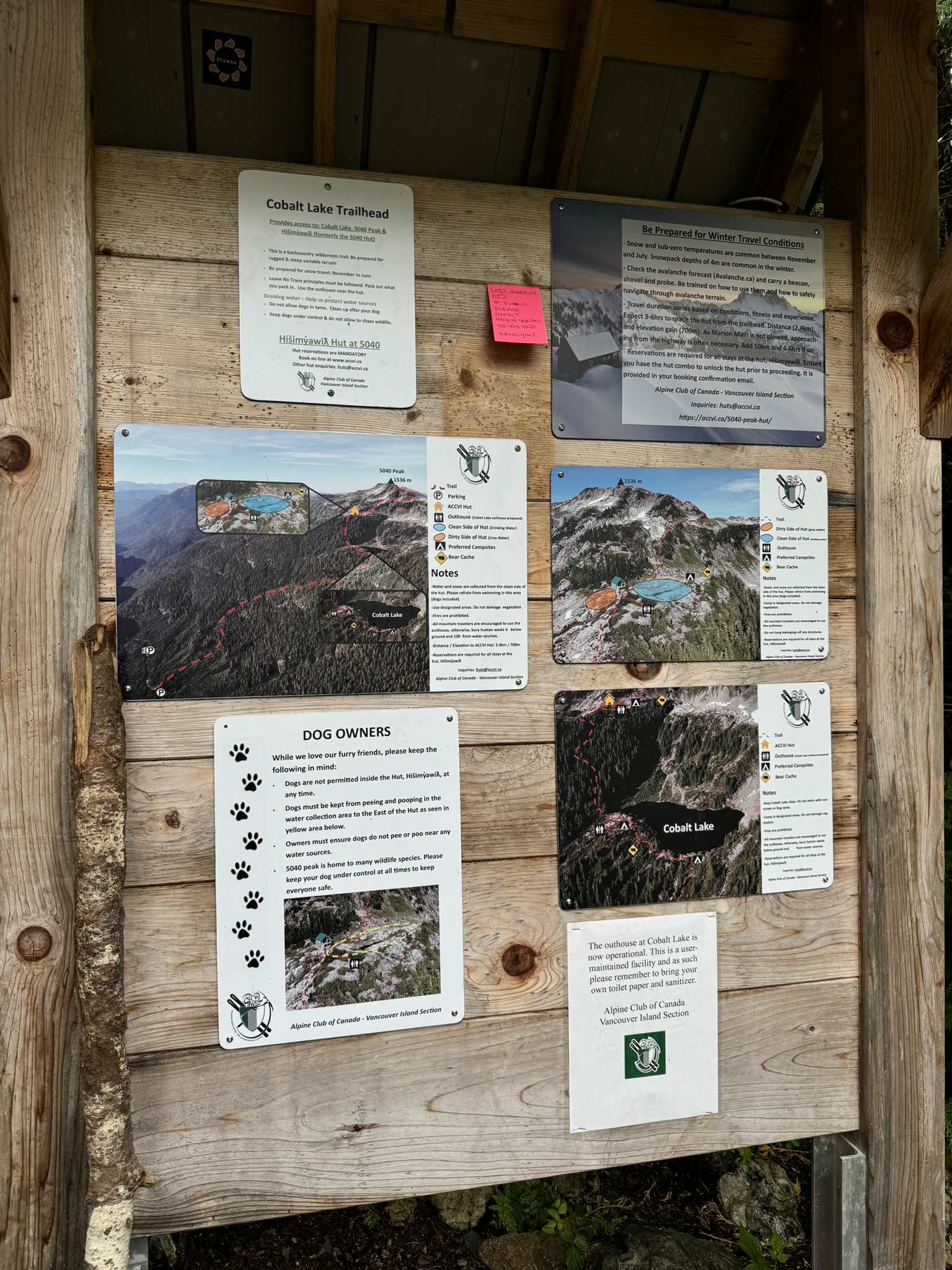
Info board at the trailhead:
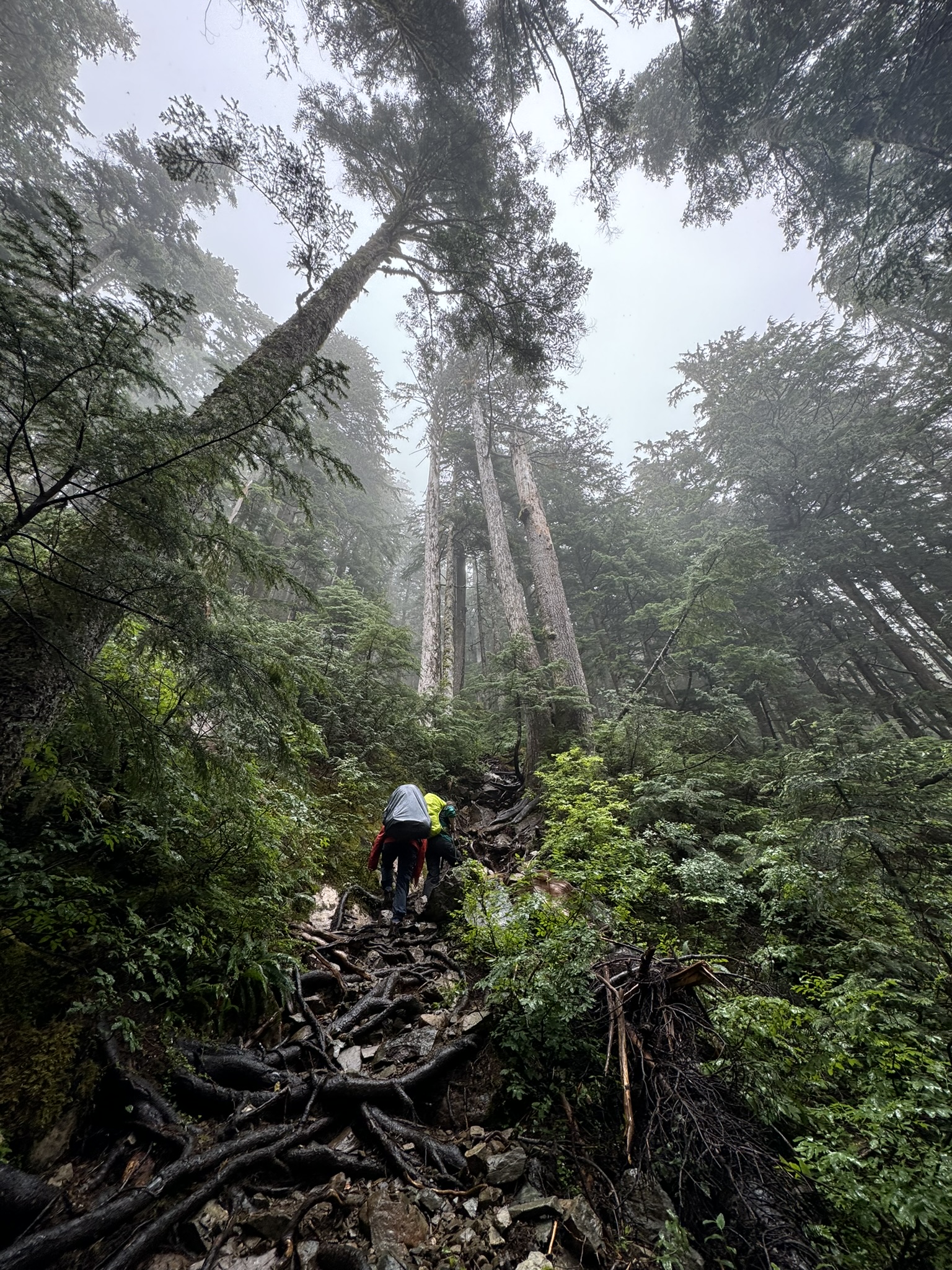
The Relentless Incline
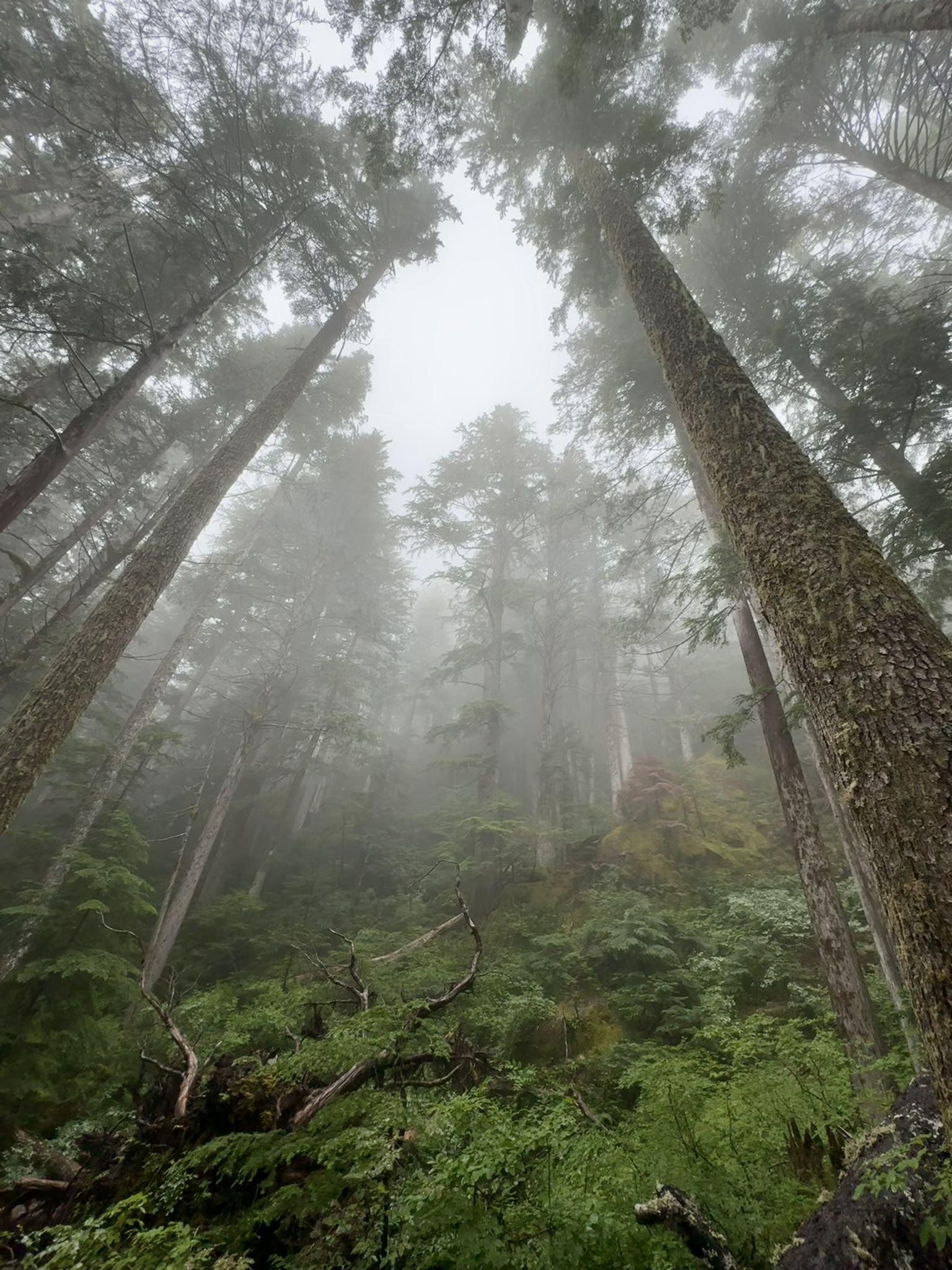
As soon as we started, we were enveloped by lush tree branches and tangled roots, which were slick from the rain. Hiking poles would have been useful for maintaining balance, but with a heavy backpack, we found it better to use our bare hands for scrambling.
It is worth mentioning the path is quite narrow, so make sure to let faster hikers pass.
The Bluff
The first break spot is a bluff lookout after a challenging 300 meters of elevation gain in merely 1km distance.
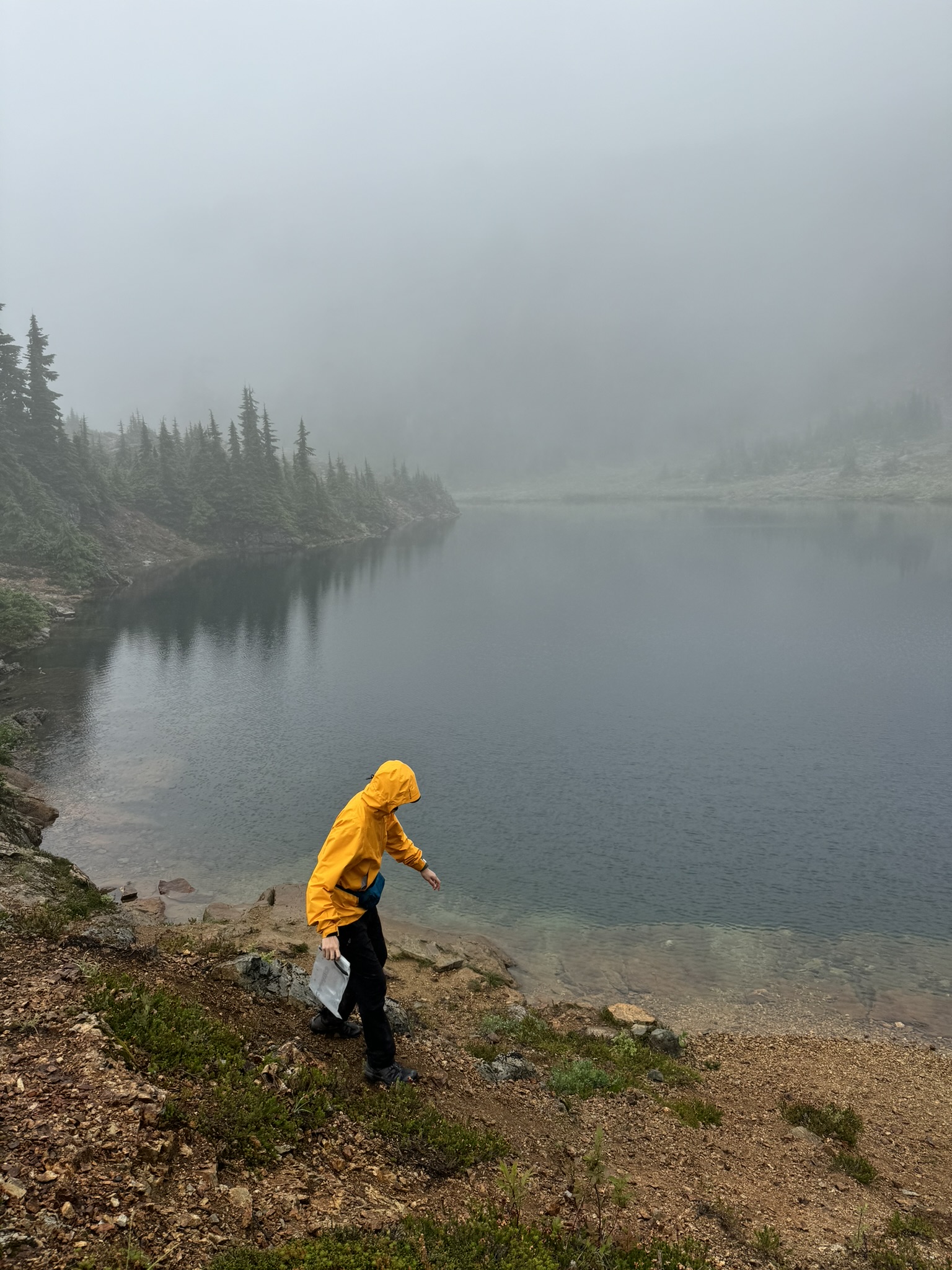
Cobalt Lake
After a quick rest, we pressed on and soon arrived at Cobalt Lake after passing through a beautiful little waterfall and meadow. This was another 200m elevation gain and 500m distance.
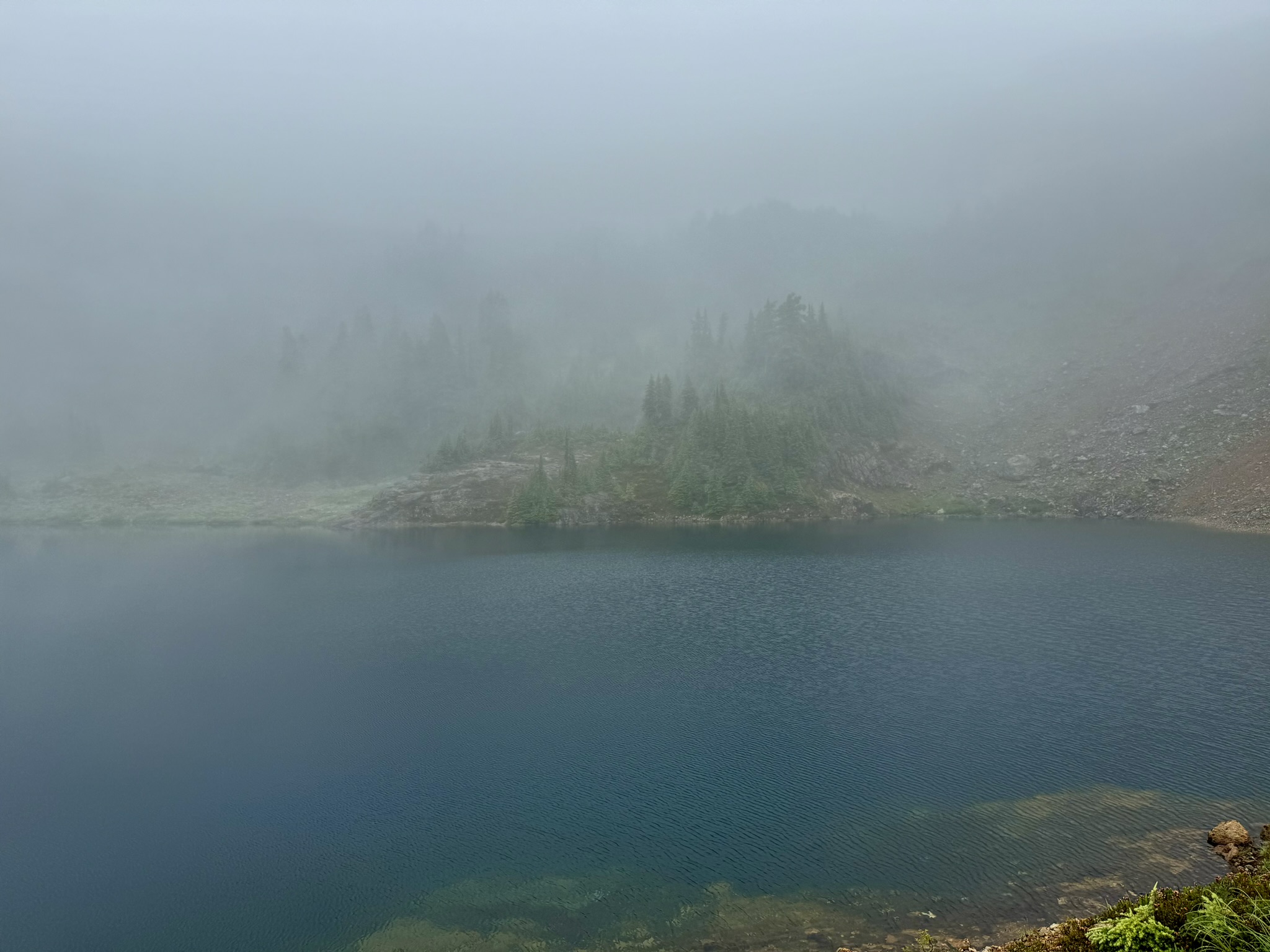
Many hikers opt to camp here and summit the peak lightweight the next day. There are lots of flat ground around the lake don’t sweat about finding a spot. There’s also an outhouse nearby.
If you’re choosing to push further and camp by the hut or up the ridge, be sure to fill up water supply here at the lake. There technically is a clean pond by the hut that’s for drinking, but we found it to be quite dried out and dirty.
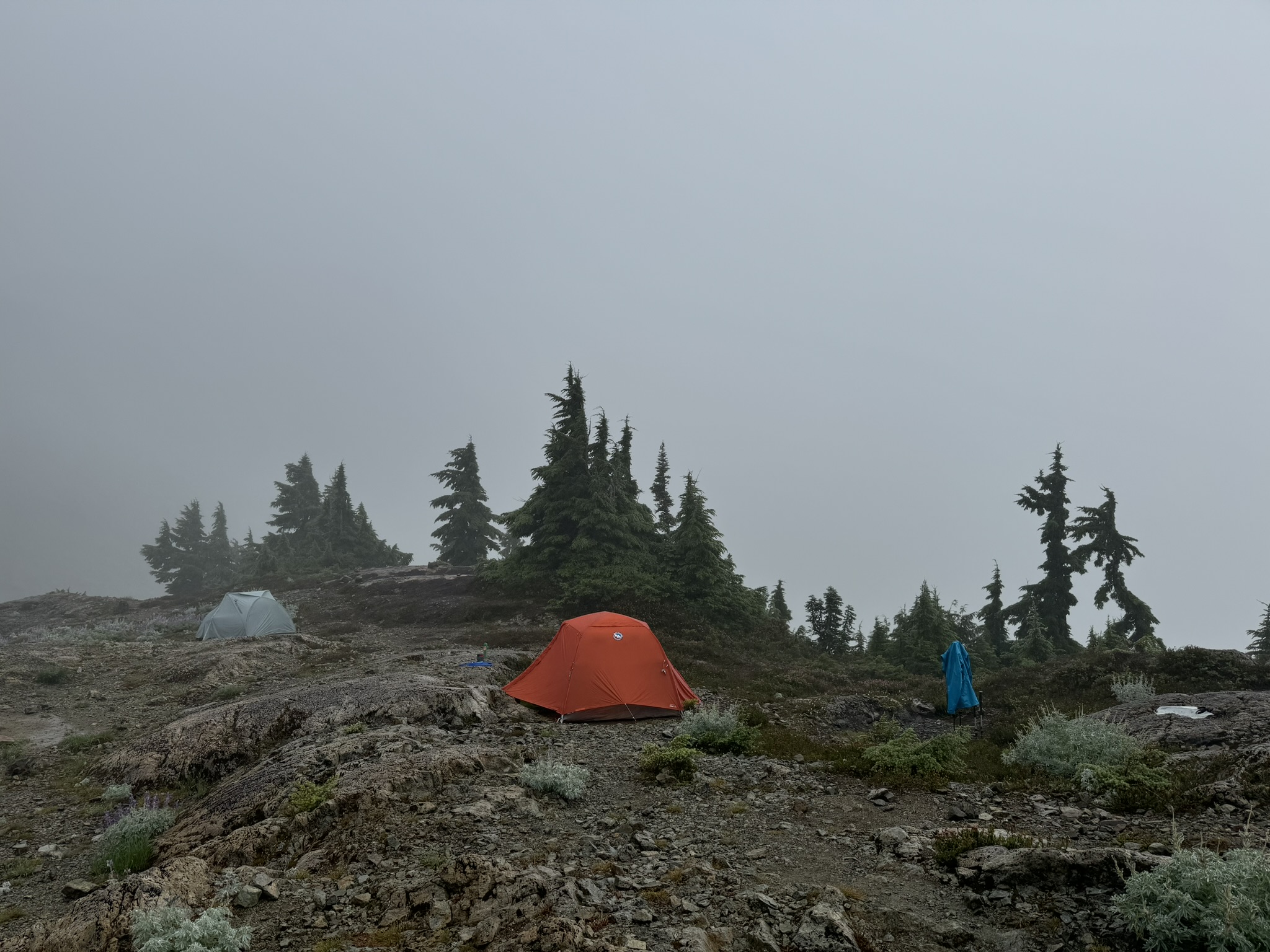
The Hut
After another 200m elevation gain and 1km distance, we arrived at the Hut at 1350m on the ridge. There is a sign right before the Hut detailing drinking water source and other safety info - make sure to read and familiarize. An outhouse and bear cache are also available nearby.
There is also a small waterfall/stream near the bear cache past the wildflowers. If you did not fill up water by the lake, this stream is an alternative to the drinking pond by the Hut - it’s at least running water!
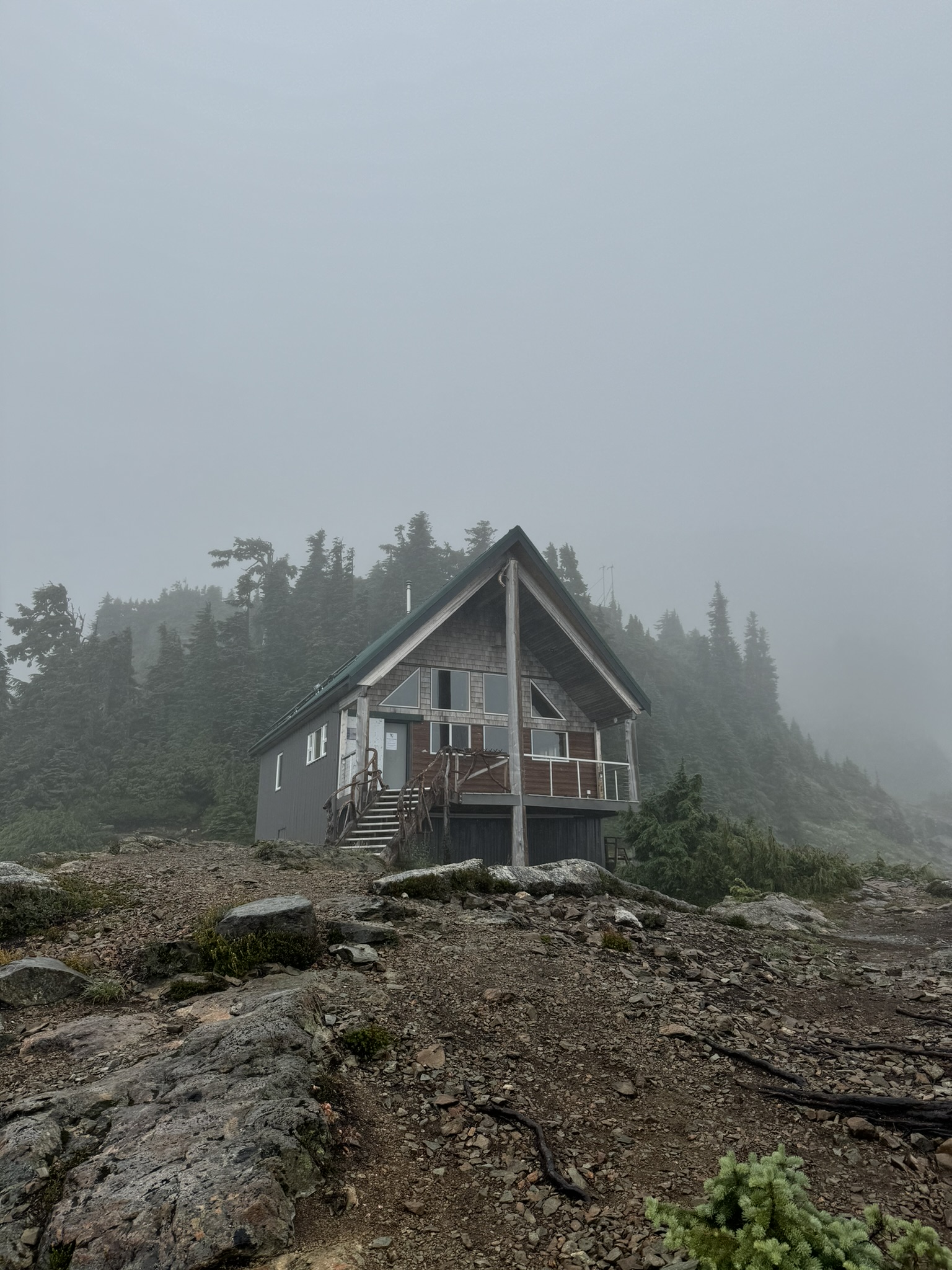
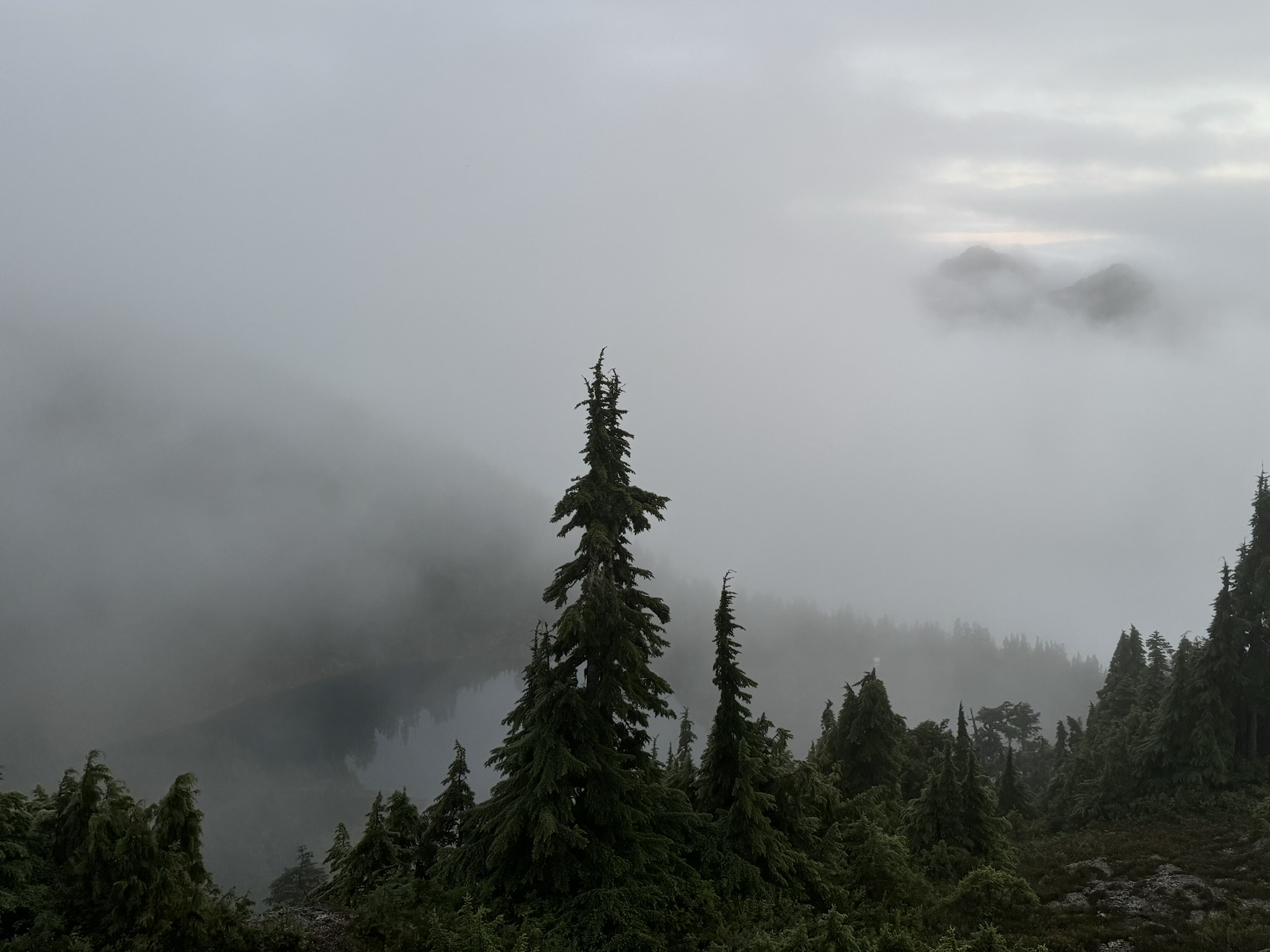
We set up camp here to rest for the night. After enjoying our Backpacker’s Pantry Pad Thai and some hot coffee, we snuggled into our tent, hoping the skies would clear up and we’d get to see the mountains when we wake up.
Waking Up to a Clear Sunrise
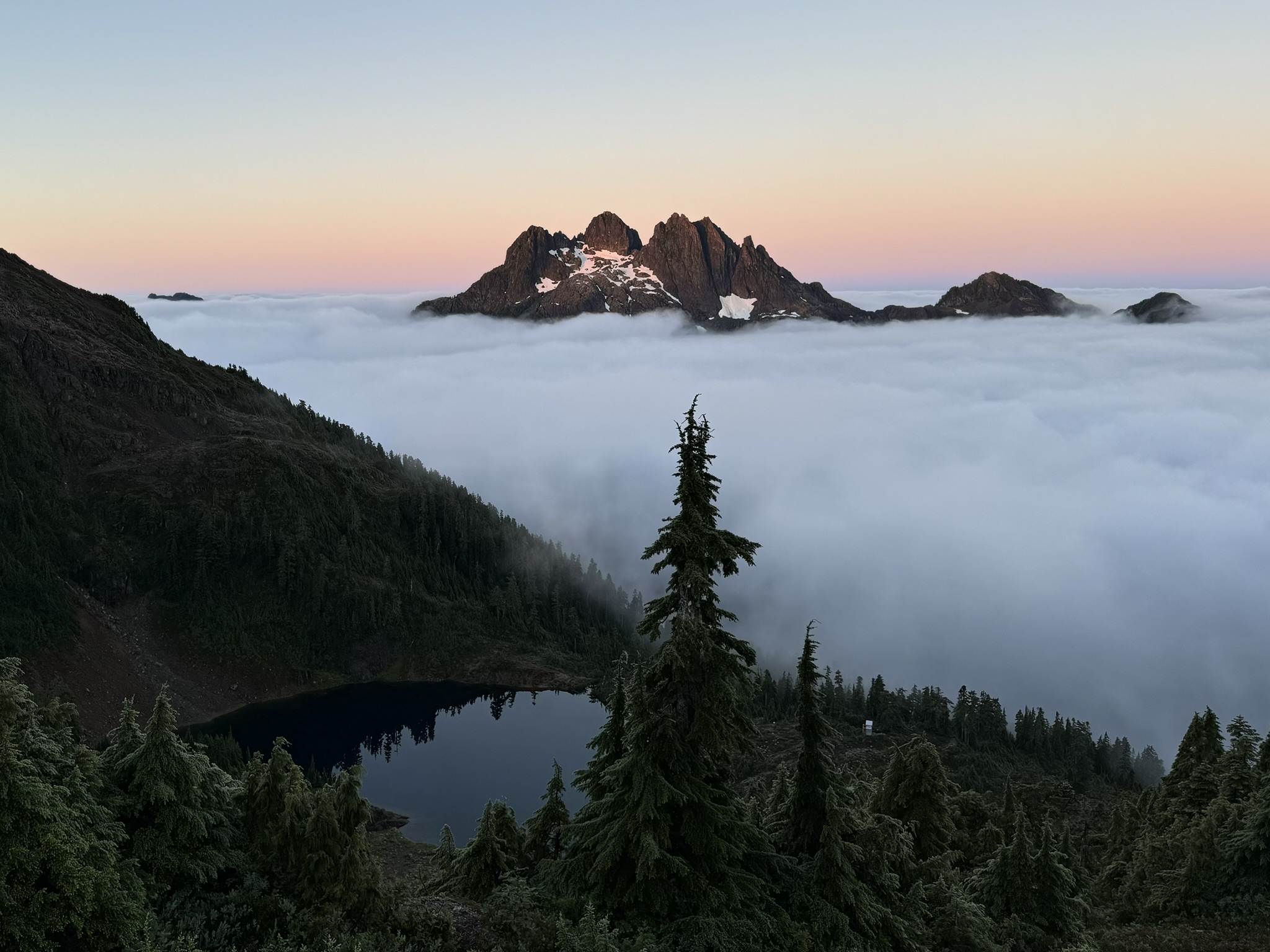
The next morning at 4:30am, we woke up to a fresh, crisp dawn.
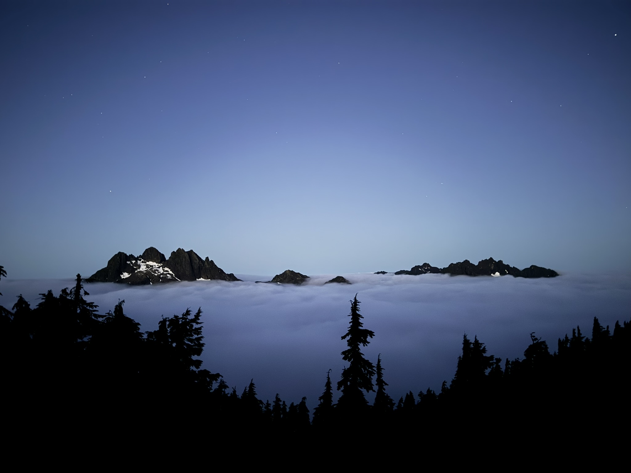
The fog had lifted, revealing the majestic mountain views that lay before us. As the first light of day painted the peaks in soft, pink hues, we settled in with steaming cups of coffee, savoring the tranquil landscape around us.

**From left to right are: Triple Peak, Cat Ears…
The High Alpine Ridge and Summiting the Peak
While the sky was still clear, we set out towards the High Alpine Ridge and the Peak. The trek involves an additional 200m of elevation gain over approximately 700m of distance, culminating at 1536 meters (or 5040 feet, where the peak earns its name).
The ascent is quite steep, but halfway up, we were rewarded with a breathtaking view of Cobalt Lake. Note you are not able to see Cobalt Lake when you’re camping by the Hut.
Once on the ridge, the terrain flattens out in comparison to the grueling climb, allowing us to relax and fully enjoy the stunning mountain vistas and alpine wildflowers.
As mentioned previously, campsite options are available up here. Note that no outhouse facility or bear cache is provided, but there is snow at this altitude that you can boil for drinking water.
After relishing the alpine playground and capturing countless photos, we noticed the fog beginning to roll back in. We thus headed down to pack up our tent and descend into the mist before it turned to rain.
The Descend and Depart
TBC
This trip was the perfect embodiment of “Vancouver Island: Rain, fog, and sometimes sun.”